Many valuable ecological features such as tidal wetlands, coastal prairies, and upland and bottomland forests remain within the Greater Houston-Galveston area, and even in Houston’s urban core. Efforts to preserve forested riparian buffers around area creeks and bayous is providing greenway recreation space for city residents, (Spring Creek Greenway, Houston’s Urban Bayous), and grassroot efforts have saved a rare native prairie (Deer Park Prairie). For every landscape that is preserved, even more are threatened by the pressures of development and conversion to non-native uses.
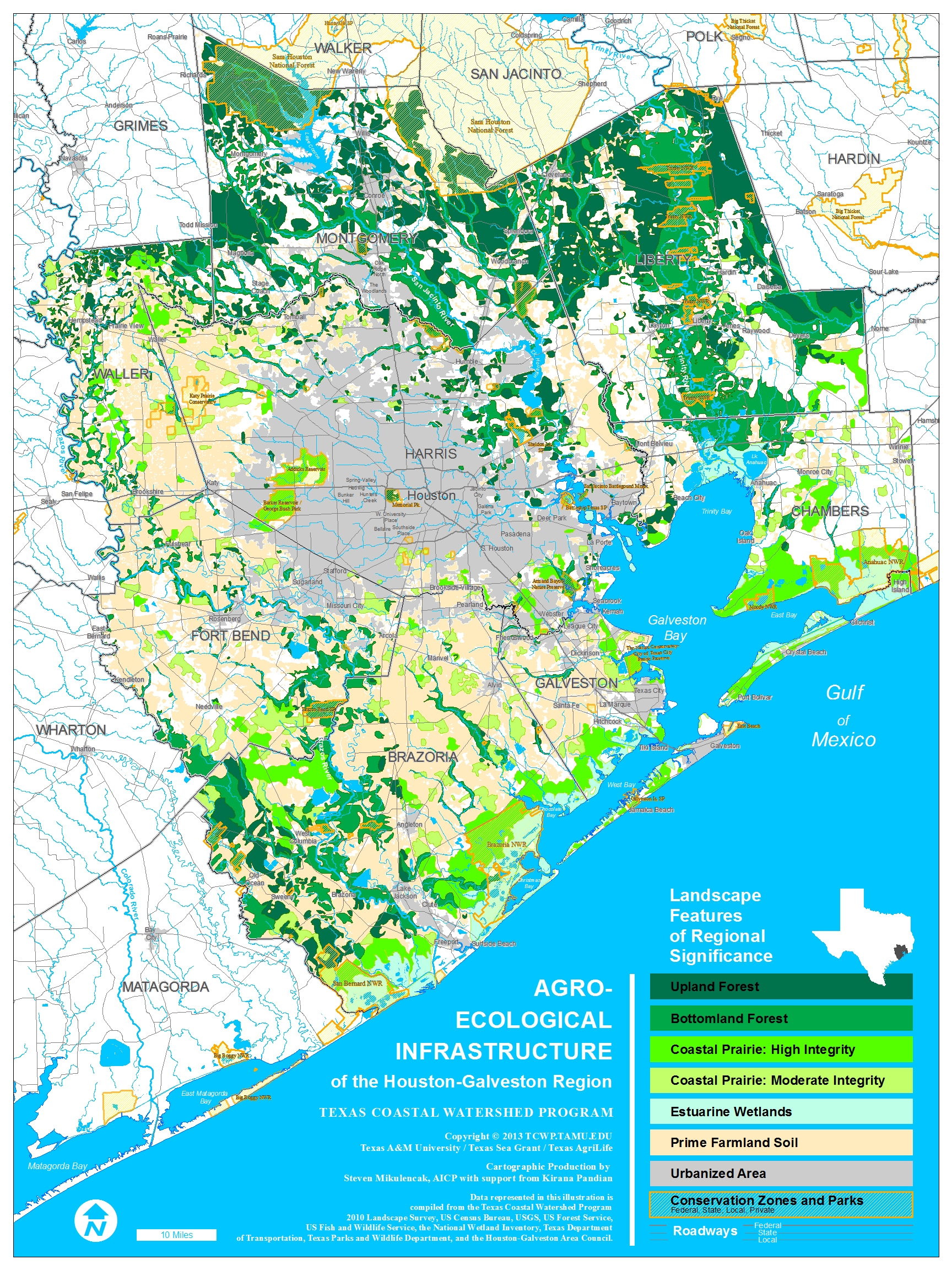
The TCWP mapped remaining habitat across the 8-county metro Houston region in 2012. Aerial photographs were used to locate remnants of coastal prairie pothole complexes and upland and bottomland forests. Only those pieces of habitat larger than 100 acres were mapped. One hundred acres is a minimal threshold for some semblance of ecological values. In addition, mapping much smaller areas, say 5 acres, would have exponentially increased the amount of time required to complete this map.
The TCWP then worked with H-GAC and other partners to develop a comprehensive geographic-information-system user interface to examine the data and to compare impacts on these habitat remnants from roads or development.
Click the map to look at a much larger .PDF of the habitat.
Click Here to view H-GAC’s interactive mapping tool.
